Jun 19, 2019
A new deep learning approach enables the first large-scale charting method that can quickly create high-resolution land maps at a fraction of the cost.
Being able to predict land cover at a fine resolution from satellite imagery is an extremely important and challenging task in producing key information for many sustainability-related problems.
In an effort to tackle this need on a large scale, a Microsoft research team led by Georgia Tech Ph.D. student Caleb Robinson created the first high-resolution land cover map of the contiguous United States.
This specialized map combines satellite and aerial imagery with deep learning – a specialized field within artificial intelligence – to show potentially daily changes in land types such as water, forests, fields, and human developments. The Microsoft AI for Earth–funded project will be used in a wide range of applications, particularly by conservation biologists to detect and analyze changes in environments.
“The goal is to identify and summarize changes in land cover on the scale of days,” said Robinson. “The scale of days is extremely important as this can inform conservation agencies as to how effective their interventions are or this can highlight potential problem areas such as rapid loss of forest cover.”
Bistra Dilkina, a School of Computational Science and Engineering adjunct professor and researcher who specializes in technology for conservation, is a co-investigator on this project and advisor of Robinson’s.
"Overall, artificial intelligence has a lot to offer in helping conserve our environment, from land cover mapping and detection of degradation to optimizing conservation planning and predicting risk of illegal wildlife poaching in protected areas,” she said.
These conservation assessments and planning initiatives made possible by high-resolution land maps are important to the health of natural ecosystems and surrounding populations. However, these maps were previously created manually or semi-manually — an extremely expensive and painstakingly slow method that scales poorly over large areas.
By introducing a multi-resolution data fusion method for deep learning–based high-resolution land cover mapping, the team has successfully reduced the time needed to create this type of map as well as the cost.
“Other deep learning–based methods for land cover mapping have shown to be effective but are limited in their scale,” said Robinson. “By developing methods for generalizing models to new regions, we have achieved high-quality results for the entire US.”
An example of this cost and time disparity can be seen in the creation of the land cover map of the Chesapeake Bay Watershed in the northeast US. The Chesapeake Conservancy spent 10 months and $1.3 million to produce the map for an area that measures at approximately 64,299 square miles. Now, with the development of this new method, the team was able to produce a country-wide high-resolution land cover map of 3.20 million square miles within a week for a cost of $5000.
It also opens the doors to future environmental organizations with limited funding within the US or other areas with commercial satellite imagery providers.
To see an example of this map’s abilities, Robinson’s team partnered with the Chesapeake Conservancy to test this new method by producing a land cover map for the Middle Cedar Watershed in Iowa. This particular map was used to produce high-resolution flow path data sets in order to identify opportunity areas for planting riparian forest buffers – vegetated spaces that protect streams from collecting pollutants from adjacent areas.
The deep learning method and a detailed account of how the team collaborated with the Middle Cedar Watershed is outlined in a paper, set to be presented at the premier annual computer vision conference, CVPR 2019, Thursday, June 20.
An addition to the map outlined in the paper is a new web interface that allows users to:
- Explore land cover model predictions
- Fine-tune the model to new geographic areas
- Extend the model with new, user defined classes
- Download resulting land cover data
The code for training and testing these models can be accessed here.
Related Media
-
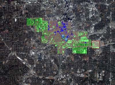
Atlanta Land Cover Map